Welcome to Auglaize County History and Genealogy!
Where we invite you to experience our past in a whole new way.
Why the moon reference? Check out the History page to learn about one of our famous native sons. The County is rich in history beyond the imagination. You only have to search to uncover its mysteries.
Facts About Auglaize County:
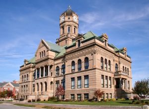
- The county seat is: Wapakoneta (Wa – pa – kon – eta)
- Year Organized: 1848
- Square Miles: 402 square miles
- Parent Counties: Allen & Mercer
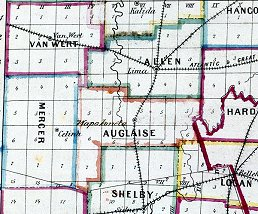
Auglaize County was formed on February 14, 1848 from portions of Allen, and Mercer Counties. Auglaize County was named for the Auglaize River, which runs through Western Ohio. The origin of the name Auglaize has been historically debated, with interpretations including a Native American word meaning “fallen timbers” and a French reference to the clay-filled waters of the river.
The county is crossed by the Auglaize River and the Miami and Erie Canal. The headwaters of the Saint Marys River, the Great Miami River and the Scioto River as well as portions of Grand Lake St. Marys and Lake Loramie are located within the county.
The city of Wapakoneta was named for an Native American Chief and stands on the site of an old Shawnee settlement. In earlier days the city was known for its wooden toys and furniture.
Oldest available Records:
| Birth | Marriage | Death | Land | Probate | Court |
|---|---|---|---|---|---|
| 1867 | 1848 | 1867 | 1835 | 1852 | 1848 |
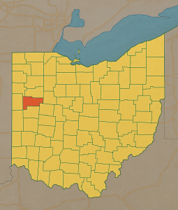
Neighboring counties:
- Allen County (north)
- Hardin County (east)
- Logan County (southeast)
- Shelby County (south)
- Mercer County (west)
- Van Wert County (northwest)
Coming Soon!
Darke County OHGenWeb —
Under construction and growing! Check back soon! 🏗️
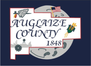
Description of the Auglaize County Flag
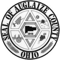
Description of the Auglaize County Seal
Designed and drawn by Larry McLean.
Copyright © 2026 Auglaize County OHGenWeb
Contact: Email the County Coordinator